Syria has no public transport map. We are building one, free.
Millions of Syrians ride state buses and servees lines every day, yet there is no public transport map of Syria, not printed, not digital. While building Ziko we decided to fix that, and the map will be free for everyone.
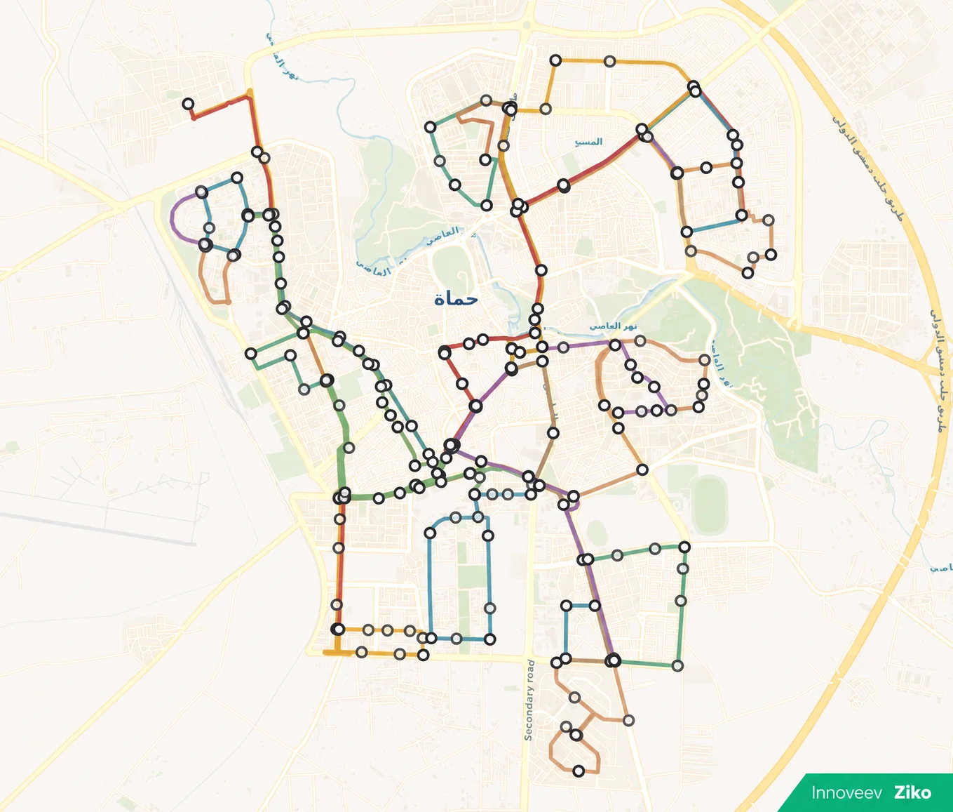
How do you get from Baramkeh to Mezzeh by bus? You ask around. That is the whole system. Syrian cities move on state buses and servees lines that carry millions of people every day, and not one of those routes exists on a map you can open.
The gap we hit while building Ziko
We noticed it during field research for Ziko, our ride-hailing app for Syria. We were studying how people actually move between neighborhoods and cities, and we kept looking for a reference map of bus and servees routes to build on. There is none. As of 2026, Syria has no official public transport map, printed or digital. Not for Damascus, not for any governorate.
The knowledge exists, but it lives in people's heads. Drivers know their own line. Regulars know their own stop. Everyone else asks, guesses, or pays for a ride they did not need. If you are new to a city, back after years away, or just crossing into an unfamiliar district, you are on your own.
So we are building the map ourselves
Once it was clear no map existed, our founder, Eng. Hasan Kassas, made a simple call: Innoveev would build one and give it away. Not a paid feature, not locked behind an account. A free public transport map of Syria, funded by us, open to everyone.
The map pinpoints public transport routes across Syrian cities, starting with the state bus network, the lines people know as government buses. Servees and intercity routes are on the roadmap too. We are open to mapping all of it, we just need enough verified data first.
The map will live inside the Ziko app when it launches in Q4 2026. Open the app, open the map, and see where the buses actually go. It will be 100% free.
Where the mapping stands today
Our team is collecting and verifying routes city by city. Right now we have working data for Damascus, Tartous and Hama, with Hama the furthest along. It is slow, careful work. Routes change, stops move, and a wrong line on a map is worse than no map at all.

Help us map Syria
This is where you come in. If you know a route, a stop, a fare, or a correction for any line in any Syrian city, we want to hear it. Bus drivers, daily riders, people who work in transport, anyone. Our team reviews and verifies every submission before it goes on the map.
Write to us at support@innoveev.com. A line name and the neighborhoods it passes through is already a real contribution.
Why this lives in Ziko
Ziko is Innoveev's own ride-hailing app for Syria, and it is built to be the safest ride-hailing app in the country: every driver passes full identity verification before their first trip, and every ride is tracked live from start to finish. Drivers pay 0% commission and keep 100% of the fare, and the whole app runs on cash, the way Syria actually pays.
A public transport map is not a revenue feature. Most people who open it will never book a ride, and that is fine with us. We say we build for how Syria moves, and we cannot claim that while the most used transport system in the country stays invisible.
Questions people ask
Is there a public transport map of Syria?
No. As of 2026 there is no official public transport map of Syria, digital or printed. Innoveev is building the first free one, covering state bus routes first, inside its Ziko app.
When will the map be available?
It ships inside the Ziko app at launch, planned for Q4 2026, with routes for Damascus, Tartous and Hama first and more cities as their data is verified.
Will the map be free?
Yes. 100% free, for everyone, inside the Ziko app.
How can I help?
Send routes, stops, fares or corrections to support@innoveev.com. The team checks every contribution before it is published.